Official decision of the Iraqi Marshes’ inscription on the UNESCO World Heritage List
The World Heritage Committee,
Having examined Documents WHC/16/40.COM/8B, WHC/16/40.COM/INF.8B1 and 1.WHC/16/40.COM/INF.8B2,
Inscribes The Ahwar of Southern Iraq: Refuge of Biodiversity and the Relict Landscape 2. of the Mesopotamian Cities, Iraq, on the World Heritage List on the basis of criteria (iii), (v), (ix) and (x);
Takes note of the following provisional Statement of Outstanding Universal Value: 3.
Brief Synthesis
The Ahwar of Southern Iraq evolved as part of the wider alluvial plain during the final stage of the alpine tectonic movement, which also lead to the evolvement of the Zagros Mountains. This took place during the late Pliocene to early Pleistocene eras. Several factors intertwined to construct the property including; tectonic movements, climatic changes, river hydrology dynamics, precipitation variation, and changes in sea level. The sea level variation and the climatic changes had a significant role in influencing the quantity and quality of water entering the Ahwar through rivers and their branches, in addition to advancement and regression of the sea and intrusion during dry to semi-dry to wet conditions during the last 18,000 years.
Between the 5th and 3rd millennium BCE, the level of the Arabian Gulf reached its maximum extent some 200 km inland of the present coastline with marshes stretching further inland. The marshy and moving landscape of this deltaic plain was the heartland where the first cities flourished. Uruk, Ur and Eridu, the three cultural components of the property, were originally situated on the margins of freshwater marshes and developed into some of the most important urban centers of southern Mesopotamia. These cities saw the origin of writing, monumental architecture in the form of mudbrick temples and ziggurats, and complex technologies and societies. A vast corpus of cuneiform texts and archaeological evidence testifies to the centrality of the marshes for the economy, worldview and religious beliefs of successive cultures in southern Mesopotamia.
Starting in the 2ndmillennium BCE, the sea regressed towards the south. This led to another climatic change towards a more arid environment and the drying up of the ancient marshes. Environmental change contributed to the decline of the great cities of southern Mesopotamia. Today the mudbrick ruins of Uruk, Ur and Eridu are dominated by the remains of ziggurats which still stand high above the arid but striking landscape of the desiccated alluvial plain. With the regression of the Gulf, new marshes formed to the southeast. The main components of the Ahwar as we know them today were formed during this period around 3,000 years ago.
The Ahwar are generally fed by the branches of the Tigris and Euphrates, in addition to extremely low winter rainfall and subsequent floods. These factors collectively determine the surface area covered by water as well as its fluctuations; the peak taking place in the flooding season associated with rainfall upstream in the basin during winter and then affected by the snowmelt during spring, and reaching the lowest levels during the dry p. 201
summer period. This fluctuation in water levels and surface areas has resulted in highly dynamic and variable ecological conditions.
The Huwaizah Marshes component is a unique freshwater system, receiving high water quantities from floods and limited amounts of seasonal rain which descends from the northern and northeastern heights. Concurrently, it is the sole natural component that was not subject to drastic drought during the man-induced drainage phase in the 1980s and 1990s, leading to the salvation of its key ecological elements. This led it to become the primary refuge for many of the key bird species of African and Indian origin in the Middle East, which have since spread back to other components after the reflooding took place in early 2000s.
By contrast, the Central Marshes component comprises today’s ecological core of the Ahwar. Being distinctive for its horizontally extensive ecosystems, it provides a vast habitat for many of the viable populations of taxa of high biodiversity and conservation importance.
Moving towards the east and south, the East and West Hammar Marshes components embrace a particular ecological phenomenon in contrast with the other components. Here, the salt water from the sea progresses inland affected on one side by tidal movements in the southern-most regions of marshes, while on the other side, pushing its way into the extended desert to the southeast. This creates very specific ecological conditions with fish species from marine origins utilizing the area for reproduction in the East Hammar, while the West Hammar comprises the last stopover area for millions of migrating birds before entering the vast Arabian Desert.
Criterion (iii): The remains of the Mesopotamian cities of Uruk, Ur and Eridu offer a complete testimony to the growth and subsequent decline of southern Mesopotamian urban centers and societies from the Ubaid and Sumerian periods until the Babylonian and Hellenistic periods. The three cities were major religious, political, economic and cultural centers which emerged and grew during a period of profound change in human history. These three components of the property bear witness to the full repertoire of the contribution of southern Mesopotamian cultures to the development of ancient Near Eastern urbanized societies and the history of mankind as a whole: the construction of monumental public works and structures in the form of ziggurats, temples, palaces, city walls, and hydraulic works; a class structured society reflected in the urban layout which included royal tombs and palaces, sacred precincts, public storehouses, areas dedicated to industries, and extensive residential neighborhoods; the centralized control of resources and surplus which gave rise to the first writing system and administrative archives; and conspicuous consumption of imported goods. This exceptionally creative period in human history left its marks across place and time.
Criterion (v): The remains of the ancient cities of Uruk, Ur and Eridu – today in the desert but originally situated near freshwater marshes which receded or became saline before drying up – best exemplify the impact of the unstable deltaic landscape of the Tigris and Euphrates upon the rise and fall of large urban centers. Testimonies of this relict wetland landscape are found today in the cities’ topography as traces of shallow depressions which held permanent or seasonal marshes, dry waterways and canal beds, and settlement mounds formed upon what were once islets surrounded by marsh water. Architectural elements, archaeological evidence and an important corpus of cuneiform texts further document how the landscape of wetlands contributed to shaping the religious beliefs, cultic practices, and literary and artistic expressions of successive cultures in southern Mesopotamia. The contemporary Ahwar of southern Iraq bear a strong cultural significance as they offer the closest living representation of the environmental context which fostered the development of the first cities and complex societies in the region, and fashioned the worldview of Mesopotamian cultures. The association of the contemporary Ahwar with some of the most prominent and best documented ancient urban centers of southern Iraq allows for understanding the unique ancient cultural landscape of alluvial Mesopotamia where cities were islands embedded in a marshy plain.p. 202
Criterion (ix): The site contains outstanding examples representing ongoing ecological and biological processes in the evolution and development of terrestrial, fresh and salt water ecosystems and communities of various taxa.
The Ahwar of southern Iraq may be one the largest-scale wetland ecosystem that is located in the most arid environment globally. The grand mosaic of the four components of the property is an exceptional example of ongoing ecological processes which reflect this extreme and harsh environment, particularly regarding almost complete dependence on riverine influx and negligible direct contribution of precipitation on-site to the water budget, very high water temperatures around or in excess of 30°C in summer with no thermal stratification of the water column, high irradiation which leads to very high primary production, high dissolved oxygen concentrations throughout the water column and high overall ecosystem productivity.
The bird migration and the migration of fish and shrimp species which occur within the property’s habitats reflect an adaptation process by these animals to long-term seasonal fluctuations in water levels and other ecological variables.
The Ahwar have developed an amazing ecological resilience, remarkable adaptive capacity against fluctuations and environmental change, in addition to the velocity of recovery processes. The Ahwar of Iraq are set apart by the fact that the last dramatic recovery process took place very recently, right after the drastic destruction of the Ahwar during the second half of the last century and the re-flooding of the Ahwar at the beginning of the new millennium.
Criterion (x): The proposed site contains highly important and significant habitats for in-situ conservation of biological diversity, including those containing threatened species of high conservation and scientific importance. The Ahwar of southern Iraq are one of the world’s most important freshwater ecosystems situated within an extremely arid environment with some of the highest evaporation and transpiration levels, and some of the lowest levels of rainfall. They can be considered a “wetland island in a vast ocean of desert”. The Ahwar embrace a mosaic of habitats critical for a significant number of taxa, including globally threatened and range-restricted species and isolated populations, thus creating a site of global caliber in terms of species of conservation priority.
The Ahwar host 12 globally threatened bird species, such as the vulnerable Marbled Teal. Another vulnerable species, the Basra Reed-Warbler, which is a restricted-range species, has more than 70% of its breeding population in the Marshes. The Ahwar also include critical natural habitats for three threatened mammal species, including the Smooth-coated Otter and the Bunn’s Bandicot Rat. The Euphrates Soft-shell Turtle is an endangered species that is only known from a few localities in Iraq and Iran, whereas Murray’s Comb-fingered Gecko has a restricted range limited to the Ahwar, Shatt Al Arab and the Iranian western shores on the Arabian Gulf.
Integrity
The three archaeological ensembles included in the property offer a comprehensive picture of the Ubaid and Sumerian urbanization process within their original marshlands environment. All the major archaeological and architectural features of Eridu, Uruk, and Ur are contained within the boundaries of the property ensuring that each component part bears a complete significance and contributes to expressing the Outstanding Universal Value of the property as a whole.
The use of mud as the main building material in southern Mesopotamia creates specific conservation conditions. The toll which the passing of time took on the abandoned southern Mesopotamian cities is heavier than in the case of stone or fired brick architecture found in other regions of the ancient world where remains can be monumental and visually impressive. Yet the remains of the four ziggurats of Eridu, Uruk and Ur, however eroded, still tower over the desert landscape and provide a striking visual testimony of the antiquity and durability of the most emblematic architectural features of Mesopotamian cities.p. 203
Layers of sedimentation protected the remains of Uruk, Ur and Eridu until the 20th century when archaeological excavations exposed several buildings anew. Eridu’s excavated remains were later reburied except for the ziggurat. In Uruk and Ur there were some instances of incompatible material used to consolidate or protect the remains, whereas others were left exposed with the result that some have become affected by erosion caused mainly by rain and dust storms. Furthermore, large areas of the three cities are still unearthed, leaving room for further study of archaeological and conservation techniques respectful of the property’s integrity.
Uruk, Ur and Eridu are protected under the Iraqi Law of Antiquities and Heritage and are provided with personnel to ensure the protection and monitoring of the antiquities. Lastly, only Ur has suffered limited and reversible damages during the recent conflict and remedial measures are introduced under the new management plan.
The four natural components of the property and their associated corridors comprise a vast region of over 210,000 ha, thus being of sufficient size to adequately support all key natural values including the ongoing ecological and biological processes occurring in the terrestrial, water and marshland ecosystems. The large size of the associated buffer zones around each of the four components, totaling more than 200,000 additional hectares, further serves the long term protection of the property on a whole as well as at the component level.
The four components embrace the vast majority of the breeding grounds of key bird species within different regions of the property. The breeding grounds are areas of low human intervention where reed vegetation is used to build nests on the banks of the small islets abundant in the area which are surrounded with extensive water bodies located in isolation from the dry lands and away from potential predators.
Numerous populations of more than 197 species of migrating water birds associated with the Palearctic region settle on the property and spend winter periods here during their west Eurasia-Caspian-Nile and Eurasian-Africa route migrations. The numbers of landing migrating birds is increasing on the property, paralleling the improving levels of rehabilitation. Further, increasing records of the occurrence of globally threatened species are being documented, hence reflecting positively on the property’s ecological integrity.
The existing legal frameworks in relationship to the Ahwar are well developed with the national nature conservation bylaw endorsement by the government cabinet in late 2013.
Authenticity
Considering the particulars of mud architecture, the conditions of authenticity as regards the material and substance are considered to be met by the visible presence of a series of emblematic public buildings in the three cultural components of the property. Previous excavations at Ur and Eridu have concentrated on monumental public buildings and allowed for a good understanding of the spatial organization of the political, administrative and religious sections of the cities. In Ur, the main harbor, situated outside the boundaries of the property, has yet to be excavated and the boundaries of the property might be extended at a later stage to include it. No major restoration or conservation projects have been carried out with the exception of the 1960s rebuilding of part of the outer shell of the Ur ziggurat using baked brick and limited amounts of cement. These interventions did not affect the original structure and shape of the monument. More recent conservation of the site has been done using compatible material as much as possible.
Changes in the water regime have modified the hydrological and ecological environment of southern Iraq as the marshes moved southeastward through space and time. The remains of Uruk, Ur and Eridu are today surrounded by a desert landscape and are at a significant distance from the marsh components of the property and the sea. Taking this ecological reality into consideration, the conditions of authenticity are considered to be met by including in the property the ancient cities of Ur, Uruk and Eridu.p. 204
Congratulates the State Party for the restoration work that has been undertaken to recover 4.the wetland areas in the Ahwar of Southern Iraq to date, and strongly encourages this work to continue in order to permanently secure the minimum flows needed to the property and its buffer zones;
Requests the State Party, with support of IUCN, ICOMOS and the World Heritage Centre to: 5.a) in relation to natural heritage: i) conduct further studies regarding minimum water flows needed to sustain the biodiversity and ecological processes for the inscribed property,
- ii) conduct further studies to confirm the plant, vertebrate and invertebrate diversity within the property and its surrounding landscapes,
iii) complete the designation of all of the components of the property as legally protected areas, and ensure effective legal protection to regulate oil and gas concessions, and other potentially impacting activities in the buffer zones of the property,
- iv) provide support for the maintenance of the traditional ecological knowledge held by the men and women of the Ma’adan “Marsh Arabs” communities, and for rights-based approaches to management, recognising the customary use of the property;
- b) in relation to cultural heritage: i) in order to address the highly unstable conservation conditions of the archaeological sites, undertake a programme of surveys to create a base-line delineation of the state of conservation of the property,
- ii) develop conservation programmes for all three cities on the basis of the surveys that clearly set out the various options for intervention,
iii) produce a detailed master plan/road map that ensures the conservation of the property on a sustainable basis;
- c) ensure effective implementation of the consolidated management plan and publicize it in both English and Arabic, setting out the governance systems and how it relates to management plans for individual component sites and ensuring its effective consultation and communication with local communities and other stakeholders,
- d) put in place a programme to ensure an adequate level of protection and effective site-level management capacity for all component parts of the property, and appropriate capacity building activities;
Further requests the State Party to submit an edited version of the nomination text and of the 6.map showing the boundaries according to the statement jointly signed with the State Party of the Islamic Republic of Iran;
Requests furthermore the State Party to submit to the World Heritage Centre by 1 December 7.2017 a report on the implementation of the above-mentioned recommendations for examination by the World Heritage Committee at its 42nd session in 2018.
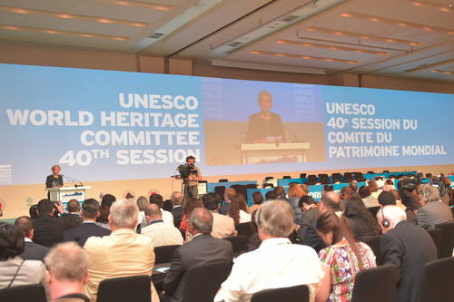
Find all documents relating to the 40th Session of the UNESCO World Heritage Committee here.
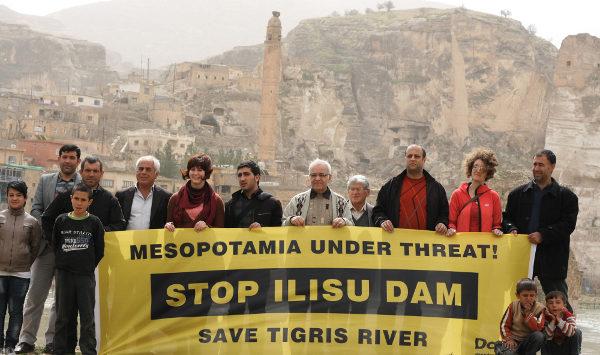
(Featured image by Didar Yesiryurt.)